TX321
TX321
End of lifeConfigurableSatellite Transmitter for GOES or Meteosat
Pricing
- Model:
- TX321
- Item Number:
- 32248
- Warranty:
- 1 year
- Lead time:
- 14 days
Overview
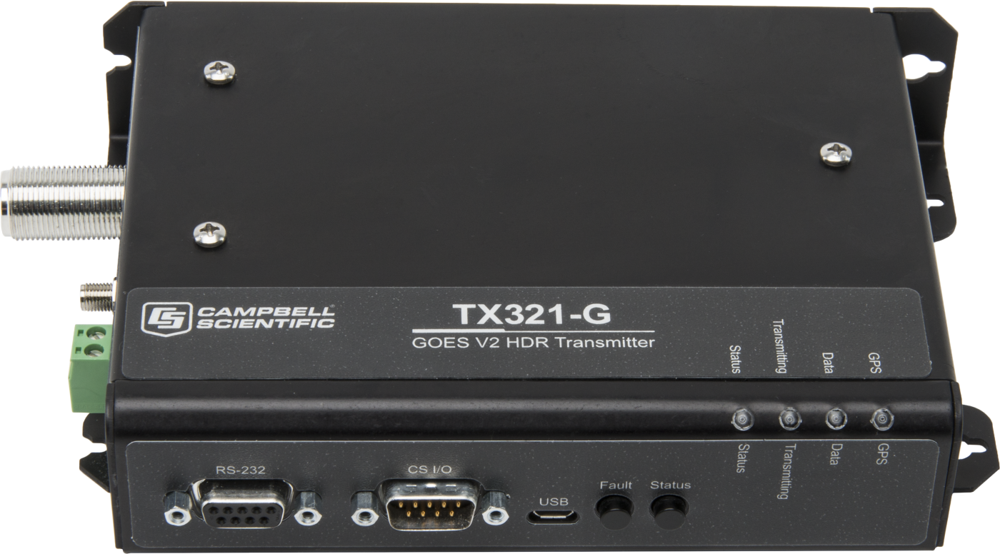
The TX321 is a GOES and Meteosat satellite data transmitter. It provides an easy and reliable way for Campbell Scientific data collection platforms (DCP) to transmit data over geostationary satellites. The TX321 is typically used by government agencies and sponsored research organizations for the purpose of collecting environmental data.
Technical Description
The TX321 is designed for use on the NOAA GOES Data Collection System and the EUMETSAT Meteosat Data Collection Services satellite networks. These networks use geostationary satellites and ground stations to receive and relay data transmitted from remote data collection platforms (DCP), such as those provided by Campbell Scientific. These DCPs are typically owned and operated by government agencies and sponsored research organizations. Users are given a frequency and time slot for their transmissions.
Data Collection Platform (DCP) Equipment
- TX321 Satellite Transmitter
- 17992 or 31182 GPS antenna and their antenna mounts and coaxial cables
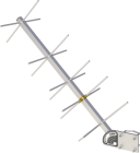
- 25316 11 dBi Right-Hand Circular Polarized (RHCP) Yagi antenna and coaxial cable
- Data logger
- Power supply, such as Campbell Scientific’s BP12 or BP24 battery, CH150 or CH200 charge regulator, and SP10 10 W or SP20 20 W solar panel
GOES System Authorization Procedure
Non-U. S. government agencies and research organizations must have a sponsor from a U.S. government agency. Prospective GOES users must receive formal permission from NESDIS, by doing the following:
- Fill out the System Use Agreement (SUA) application form. The form can be submitted online or sent to:
GOES DCS SUA Processing Unit NOAA,
Satellite Services Division
4231 Suitland Road, Rm 1646
Suitland Federal Center Suitland, MD 20746
Tel: 301-817-4563
Fax: 301-817-4569
Email: Letecia.Reeves@noaa.gov - Following approval, NESDIS sends a Memorandum of Agreement (MOA). The MOA must be signed and returned to NESDIS.
- After the MOA is approved, NESDIS will issue a channel assignment and an ID address code.
- NESDIS must be contacted to coordinate a start-up date.
Meteosat System Authorization Procedure
Complete and submit the EUMETSAT DCP Admission form.
Benefits
- GOES High Data Rate Version 2, Meteosat SRD, and International DCS operation
- Very low power consumption when idle (< 5 mA @ 12V)
- Transmissions continue for 28 days if GPS is lost
- Configuration and diagnostics easily performed by data logger or computer
- Drop-in replacement for Campbell Scientific TX320, TX312, and SAT HDR GOES
Specifications
- Transmission Distance or Area
- GOES: North America
- Transmission Distance or Area
- Meteosat: Europe
- Transmissions Supported
- Timed and random
- Transmissions Supported
- ASCII and pseudo-binary message
- Transmit RF Out Connector
- Type N jack
- Radio Module
- G6 OEM
- Operating Temperature Range
- -40° to +60°C
- Storage Temperature Range
- -55° to +70°C
- Case Dimensions
- 18.54 x 12.7 x 3.81 cm
(7.3 x 5 x 1.5 in.)
- Maximum Dimensions
- 20.96 x 13.34 x 4.06 cm
(8.25 x 5.25 x 1.6 in.) including connectors
- Weight
- 0.77 kg
(1.7 lb)
Supply Power
- Supply Voltage
- 10.8 to 16 Vdc
- Typical Current Drain
- < 5 mA
(at 12 Vdc when idle)
- Typical Current Drain
- < 100 mA
(at 12 Vdc during GPS fix)
- Typical Current Drain
- < 2.6 A
(at 12 Vdc during transmit)
- Connector
- Removable 2 pin screw terminal, 5 mm pitch
Satellite GOES
- Standards
- NOAA/NESDIS GOES High Data Rate Certification Standards version 2
- Baud Rates
- 300 and 1200 bps
- Transmit Power
- When transmitting to GOES-13 or later, transmit EIRP shall be 37 to 41 dBm for 300 bps and 43 to 47 dBm for 1200 bps.
- Transmit Power
- Settings default for use with 11 dBi YAGI antenna
- Transmit Power
- 31.5 dBm
(300 bps default)
- Transmit Power
- 37.5 dBm
(1200 bps default)
- Transmit Power
- 38 dBm
(maximum)
- Frequency Range
- 401.701 to 402.0985 MHz
- Initial Frequency Stability
- ±20 Hz disciplined to GPS
(GPS fix occurs after power up and once per day thereafter.)
- Channel Bandwidth
- 3 kHz
(300 bps)
- Channel Bandwidth
- 1.5 KHzNOAA/NESDIS GOES High Data Rate Certification Standards version 2
(1200 bps)
Satellite Meteosat
- Operation
- EUMETSAT Meteosat SRD
- Baud Rates
- 100 bps
- Transmit Power
- Meteosat SRD transmit EIRP should be 43.25 to 52 dBm.
- Transmit Power
- Default configuration for use with 11 dBi YAGI antenna
- Transmit Power
- 37.5 dBm
(100 bps default)
- Transmit Power
- 41.5 dBm
(maximum)
- Frequency Range
- 402.0355 to 402.4345 MHz
- Initial Frequency Stability
- ±20 Hz disciplined to GPS
(GPS fix occurs after power up and once per day thereafter.)
- Channel Bandwidth
- 3 kHz
(100 bps)
GPS Receiver
- Receiver Type
- 3.3 V active
- Connector
- SMA jack
Timekeeping
- Initial Accuracy
- ±100 μs
(synchronized to GPS)
- Drift
- ±10 ms/day
(without GPS)
- GPS Schedule
- 1 fix at power up
(1 fix per day afterwards)
- Transmission Continuation without GPS Fix
- 28 days
Interface Connectors
- USB
- Micro B, USB device
- RS-232
- DB9 F, DCE, 3 wire RS-232
- CS I/O
- DB9 M, SDC 4
- Satellite RF Transmit Out
- Type N jack
- GPS
- SMA jack
- Power
- Removable 2 pin
Interface Command Protocols
- Binary Command Protocol
- Available on CS I/O when connected
- Binary Command Protocol
- Available on RS-232 if CS I/O is not connected
- ASCII Command Protocol
- Available on all ports
25316 Transmit Antenna
- Gain
- 11 dBi
- Antenna Type
- Right-hand circular polarization Yagi
- Connector
- Type N female
- Wind Load
- ~100 knots
17992 GPS Antenna
- Antenna Type
- 3.3 V active dome, pipe mount
- Gain
- 28 dBi
- Connector
- TNC jack
31182 GPS Antenna
- Antenna Type
- 3.3 V active patch, magnetic mount
- Gain
- 27 dBi
- Connector
- SMA plug